Puerto Rico

Us Virgin islands

Florida USA
The purpose of a boundary survey is to establish the boundary lines of a new parcel of land, or to
reestablish the boundary lines of an existing parcel of land. The land surveyors at MFORCE will
conduct the necessary research, and collect the necessary field data, to accurately determine
where the boundary lines of your property exist.
We then physically mark these boundary lines by placing a 1”X18” iron pipe monument flush with the
ground surface at the corners of the parcel. Our staff will document any encroachments across your
boundary lines, and also document any other relevant information that may affect your rights to
your property. The results of the boundary survey are presented to you on a Certificate of Survey
drawing, which is a graphic representation of the parcel boundaries. Information documented on the
Certificate of Survey includes, but is not limited to:
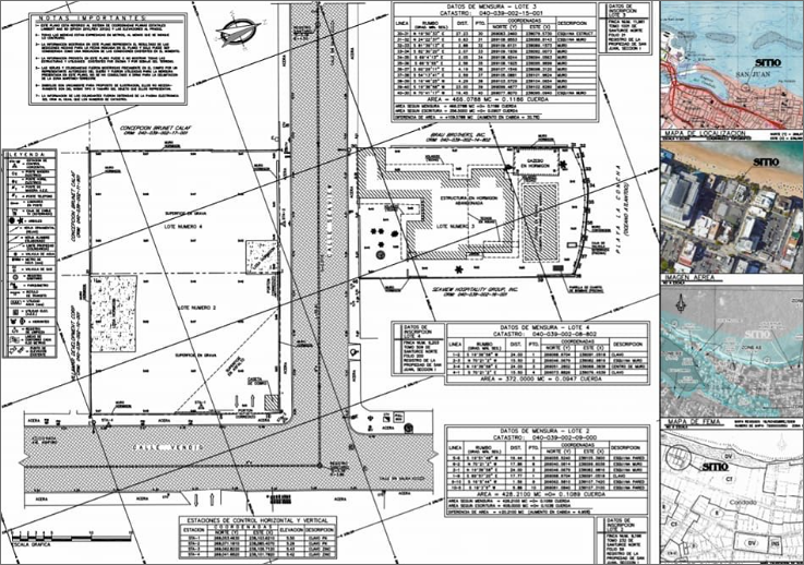
The American Land Title Association (ALTA) and the American Congress on Surveying and Mapping (ACSM) with the cooperation of the National Society of Professional Surveyors (NSPS) developed a set of standards to use when preparing Land Title Surveys. These standards are designed to give the title insurer, the buyer, and/or the lender a map drawing (survey) showing where buildings, improvements, easements, and boundaries were on the property.
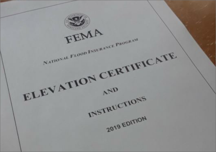
Federal Emergency Management Agency (F.E.M.A.), Elevation Certificate, a Federal application form for property shown on the Flood Insurance Rate Map (FI R M ) to be in a listed flood plain or flood hazard area, in order to show existing/proposed elevation is above the 100 year flood elevation (B.F.E./base flood elevation).
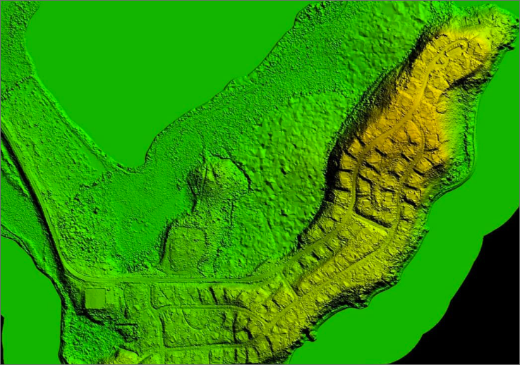
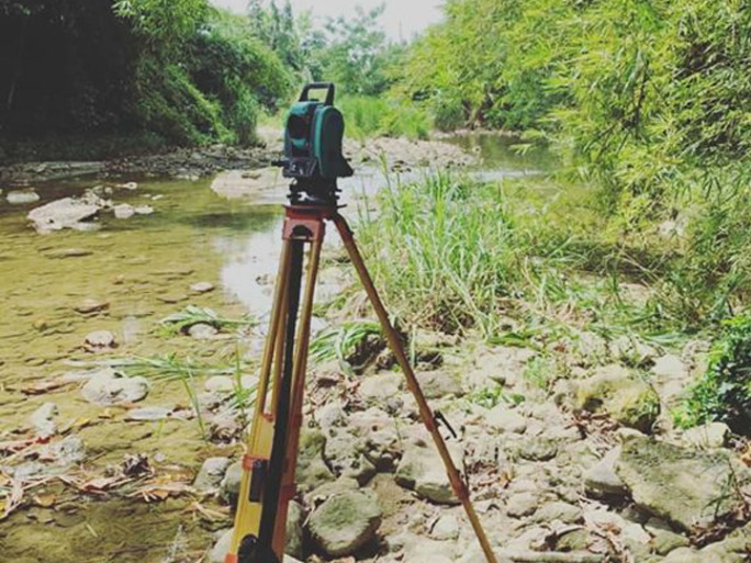
The distinguishing feature of a topographic survey is the determination of the location, both in planimetric (horizontal) and in elevation, of selected ground points which are necessary to the plotting of the contour lines and to the construction of the topographic map. This survey is similar to the ALTA-ACSM-NSPS Land Title Survey listed above, though less information is included.
This type of survey also includes aspects of the topographic survey, determination of the location, both in planimetric (horizontal) and in elevation, of selected ground points which are necessary to the plotting of the contour lines and to the construction of the topographic map, and where the primary and any auxiliary buildings are located, substantial improvements, easements (of record and prescription), and property lines on and near the subject property. This set of plans will also show proposed development of the land, proposed lot and street layout, utilities, building sites, parking, drives, sidewalks, and landscaping. All to enable the client to obtain the necessary permits for platting of the subdivision and the construction thereof. These plans will also be used in construction staking.
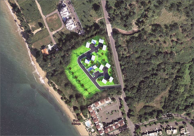
Includes aspects of the topographic survey, determination of the location, both in planimetric (horizontal) and in elevation, of selected ground points which are necessary to the plotting of the contour lines and to the construction of the topographic map, and where the primary and any auxiliary buildings are located, substantial improvements, easements (of record and prescription), and property lines on and near the subject property. This set of plans will also show proposed development of the site, proposed building locations, parking, drives, sidewalks, and landscaping. All to enable the client, to obtain the necessary permits for construction. These plans will also be used in construction staking.
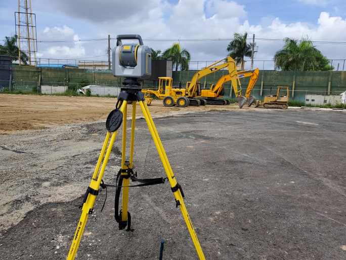
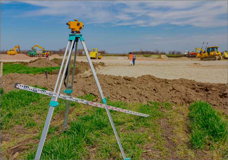
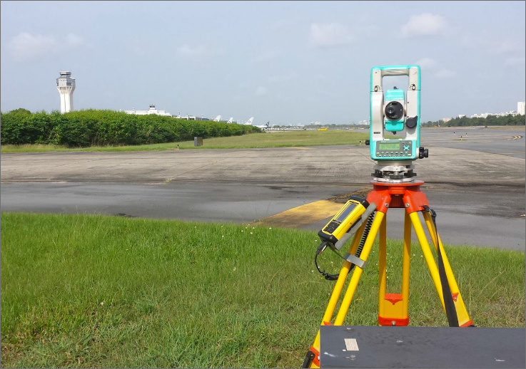
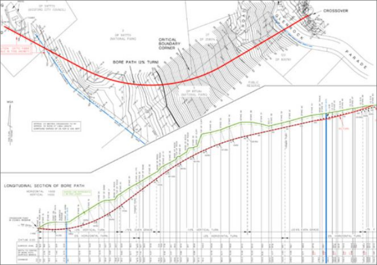
Surveys for construction usually involve the following: (1) making a topographic survey of the site, to be used in preparation of plans for the proposed development, (2) establishment on the ground of a system of stakes or other markers, both in plan and elevation, from which measurements of earthwork or other construction can be conveniently by the construction personnel, (3) giving line and grade as needed either to replace stakes disturbed by construction or to reach additional points on the structure itself, and (4) making measurements necessary to verify the location of completed parts of the project and to determine the volume of work actually performed up to a given date, as a basis of payment to the contractor.
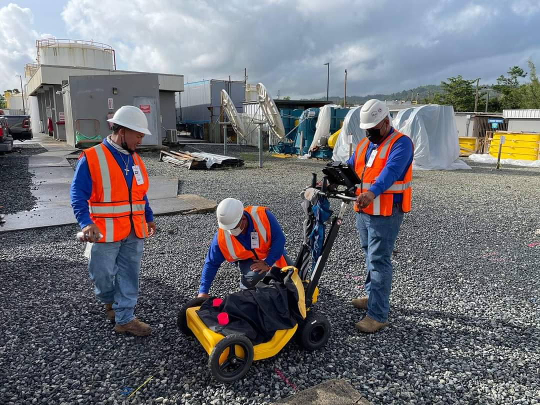

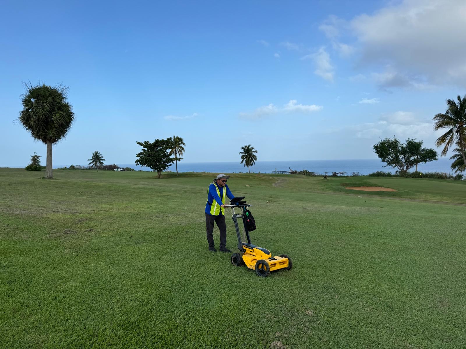
Utility location is the process of identifying and labeling public utility mains which are underground. These mains may include lines for telephones, electricity distribution, natural gas, cable television, fiber optics, traffic lights, street lights, storm drains, water mains, and wastewater pipes. In some locations, major oil and gas pipelines, national defense communication lines, mass transit, rail and road tunnels also compete for space underground.
Surveys for construction usually involve the following: (1) making a topographic survey of the site, to be used in preparation of plans for the proposed development, (2) establishment on the ground of a system of stakes or other markers, both in plan and elevation, from which measurements of earthwork or other construction can be conveniently by the construction personnel, (3) giving line and grade as needed either to replace stakes disturbed by construction or to reach additional points on the structure itself, and (4) making measurements necessary to verify the location of completed parts of the project and to determine the volume of work actually performed up to a given date, as a basis of payment to the contractor.

The Professional Land Surveyor as a fact finder and a reporter of these same facts in a court of law. An extension of accident investigations, beginning with the surveyor goes into the field to find evidence for the client, lines of site, grade changes, stopping distances, encroachments, etc., as may be required by law enforcement, insurance companies, and attorneys, when settlement cannot be reached and litigation has become the final option.
The Professional Land Surveyor as a fact finder and a reporter of these same facts in a court of law. An extension of accident investigations, beginning with the surveyor goes into the field to find evidence for the client, lines of site, grade changes, stopping distances, encroachments, etc., as may be required by law enforcement, insurance companies, and attorneys, when settlement cannot be reached and litigation has become the final option.
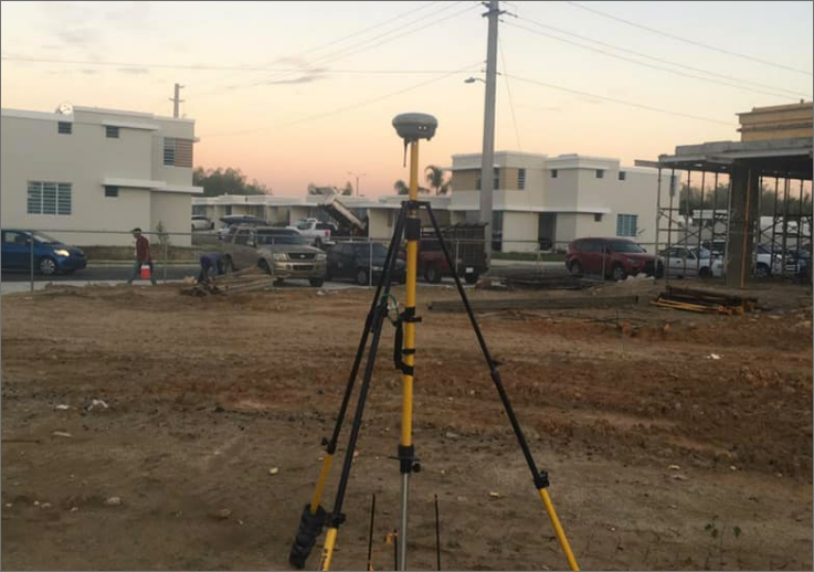
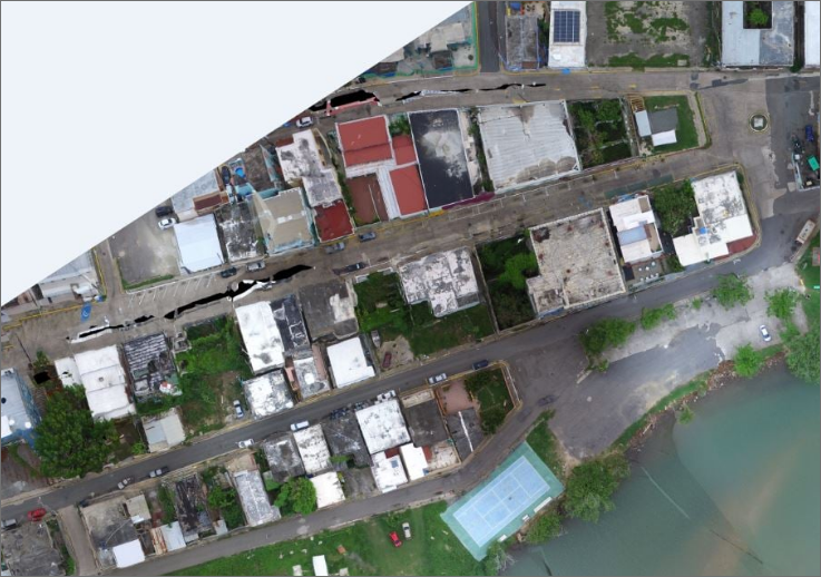
The primary purpose of a ground control survey is the determination of the location, both in planimetric (horizontal) and in elevation, of selected viewable ground points which are necessary to the preparation of the aerial map by the photogrammetrist. Our partner in aerial mapping is Pickett & Associates, Inc. located at 475 South First Ave. Bartow, Florida.
 |
|